
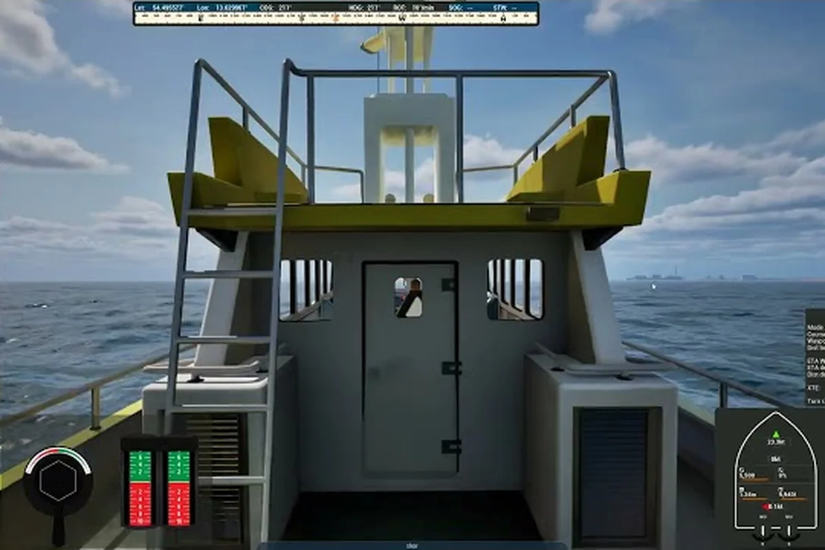
Professional Ship Simulator harbors are more than just waypoints between open-water missions — they're the visual and operational heart of the game. Built on real elevation and bathymetry data, every harbor in the 2026 Early Access build combines layered scenery, wildlife, working shipyards, and ferry infrastructure that reward players who slow down and look around. Knowing what each harbor offers helps both career-mode grinders chasing ferry lines and free-roam explorers hunting the best viewpoints along the coast.
The current map bundles two distinct regions: the dense, working-port Baltic set and the smaller, tourist-friendlier Island of Rügen. Together they cover hundreds of nautical miles of navigable coastline where the terrain you sail past and the bathymetry beneath your hull actually matter — running aground on a sandbar or missing a hidden dry-dock entrance both cost real credits. This guide walks through what every harbor in Professional Ship Simulator actually contains, how the scenery and terrain are built, where the wildlife hangs out, and which departure points to use when running ferry or repair contracts.
Harbor Types, Layouts, and Working Infrastructure
Professional Ship Simulator harbors fall into four practical categories, and each one changes the way you approach it. Understanding the differences lets you pick the right port for the mission type instead of wasting transit time sailing to a harbor that can't service your vessel.
The Four Working Harbor Categories
The first thing a new captain notices is that not every harbor offers the same services. Small fishing villages handle buoys and small-craft fishing contracts but rarely have dry-dock facilities, while the larger commercial harbors host pilot stations, ferry terminals, and repair infrastructure. Below is a quick reference of what each type generally provides.
| Harbor Type | Dry-Dock Repair | Ferry Departure | Pilot Station | Typical Vessels |
|---|---|---|---|---|
| Small Fishing Port | No | No | No | Trawler, small cargo |
| Working Commercial Harbor | Yes | Yes | Yes | Ferry, tanker, cargo |
| Tourist/Resort Harbor | Limited | Yes | No | Yacht, charter boat |
| Industrial / Repair Hub | Yes (multi-size) | Limited | Yes | Tanker, LNG, cargo |
Commercial harbors are where most career-mode income originates because they combine dry-dock access with ferry departure piers. Industrial hubs like the larger Baltic ports go a step further, supporting the bigger hull classes and offering the deepest approach channels.
How the Inner Harbor Is Structured
Most Professional Ship Simulator harbors follow a layered geometry that the developers built directly on real coastal charts. Approaching from seaward, you cross a breakwater that shields the inner basin, then pass through a narrow harbor entrance flanked by leading lights. Inside, you'll typically find:
-
An outer basin for commercial traffic and ferry berths
-
A fish auction hall or small-craft quay on the lee side
-
A dry-dock gate recessed into the seawall for repairable vessels
-
A harbor office building where pilot and inspection missions spawn
This consistent layout makes it easy to predict service availability as you approach a new port — if you can spot the breakwater, you already know where the dry-dock and ferry pier sit relative to your heading. For captains still learning the basics, the Professional Ship Simulator beginner guide covers how to read these structural cues from the bridge.
Radio Frequencies and Harbor Control
Every working harbor broadcasts on the same set of VHF channels, and contacting Harbor Control on Channel 20 is the universal first step before any service. According to community testing on the Early Access build, ferry duty missions specifically require you to request a route assignment from Harbor Control before departure, while dry-dock repairs are triggered by contacting the dock directly. Pilot ship inspection missions are requested at the local harbor via VHF, then picked up at the harbor office.
Terrain, Bathymetry, and What Lies Beneath the Waterline
One of the standout features of Professional Ship Simulator harbors is that they're not flat decorative boxes — they sit on real elevation data with real underwater depth charts. This means your bridge instruments actually show useful information, and grounding becomes a real career risk.
How the Terrain Was Built
The map's terrain comes from publicly available elevation datasets, processed and re-imported through the Unreal Engine heightmap pipeline. Coastal cliffs, dunes, and inland forests all carry the same fidelity as the harbors themselves, which is why the skyline behind a port like Sassnitz looks distinctly different from the flat horizon around a working commercial port further west. Terrain features that influence harbor approach include:
-
Coastal cliffs at the northern Baltic edges that create wind shadows
-
Sandbars at river mouths that extend the harbor approach channel by several hundred meters
-
Low-lying marsh around fishing villages where visibility drops fast in fog
-
Dune ridges that block radar line-of-sight near resort harbors
Players who want to push beyond the default terrain should look into the addon scenery mod scene for the Island of Rügen and the Baltic Sea set, which extends the playable bathymetry by roughly 12 nautical miles offshore and adds nine additional harbor approaches not present in the base Professional Ship Simulator terrain grid. Workshop contributors have re-sampled S-57 chart data for the Greifswalder Bodden, letting modded harbors match the cliff-induced wind shadow behavior already documented for the northern Baltic coast while introducing distinct dune-ridge radar occlusion around resort marinas such as Binz and Sellin.
Bathymetry and Approach Channels
Bathymetry is the underwater half of the equation, and the developers used real depth soundings to build the seafloor. This is critical because the chart interface plots your vessel's draft against the actual depth curve, and shallow areas update in real time as you approach. The approach channel is the dredged lane leading into a harbor, marked by buoys and usually 8-15 meters deep, while the surrounding seabed can quickly drop to 2 meters or less.
| Harbor Region | Approach Depth | Channel Width | Seabed Type |
|---|---|---|---|
| Island of Rügen (Sassnitz) | 9-12 m | ~80 m | Rocky |
| Western Baltic commercial ports | 8-14 m | ~100-120 m | Muddy/sand |
| Smaller fishing harbors | 3-6 m | ~30-50 m | Mixed |
| Tourist resort harbors | 4-8 m | ~50-70 m | Sandy |
A trawler drawing 3 m can clear the 4-8 m approach at most resort harbors with margin to spare, but a loaded cargo hull at 11-12 m draft has zero under-keel clearance in those same 3-6 m fishing channels listed above, and grounding triggers within a single length. Cross-check the chart interface's depth shading against your vessel's draft readout before committing, especially when the swell pushes you above the printed sounding.
Chart Interface and the Buoy System
The chart interface in the 2026 build layers bathymetric shading, seamark symbols, and your vessel's current position onto a single screen. Lateral buoys mark the port and starboard edges of the approach channel — green buoys stay to starboard when entering, red buoys to port, matching the standard IALA B convention used throughout the Baltic. Safe-water and isolated-danger buoys mark the outer edges of the channel where it widens into the open sea. If you've never used the chart system before, the navigation mechanics line up with what you'd find in any IHO-compliant plotter, and most players adapt within two or three harbor approaches.
Scenery, Wildlife, and Free-Roam Exploration
Beyond the working infrastructure, Professional Ship Simulator harbors are stuffed with scenery and ambient life that reward players who treat the map as a place to explore rather than just a routing problem. The scenery quality is one of the strongest selling points for free-roam mode, and the wildlife system adds a layer of immersion that the early community reviews have highlighted repeatedly.
Layered Scenery Around the Harbors
The scenery pipeline uses the same elevation base as the terrain, then layers in instanced vegetation, hand-placed buildings, animated lighthouses, and dynamic lighting. According to players who toured the map during the demo build, the most photogenic harbors are:
-
Sassnitz on the Island of Rügen, with its chalk cliffs and ferry terminal backdrop
-
Ramsgate at the English Channel end of the map, with its Victorian stone harbor wall
-
The smaller Baltic fishing villages, where the dawn fog and gull calls make for striking screenshots
Photo mode is the most natural way to capture the scenery, and the presets included in the 2026 build let you dial in golden-hour lighting without manually tweaking the time of day. Multi-monitor owners get the best results, but even single-screen players can pull cinematic shots by parking offshore and using a long lens.
Wildlife and Ambient Life
The wildlife system isn't a side feature — it's tied into the scenery engine and spawns dynamically around every harbor. Seagulls follow ferries out of the inner basin, cormorants perch on the breakwater beacons, and porpoises occasionally surface near the approach buoys on calm days. On shore, herons stalk the marsh edges of the smaller fishing harbors, and roe deer appear at dawn and dusk along the dune lines.
This makes professional ship simulator exploration a genuine sightseeing activity rather than a routing exercise. The wildlife is most active at the boundaries of each harbor — the breakwater, the dune ridge, the marsh edge — because that's where the procedural systems overlap. Free-roam players who want to catalog the fauna can use a slower vessel like a yacht or pilot boat to get close enough for screenshots without spooking the animals.
Exploration Routes Worth Your Time
A good free-roam loop ties together the working infrastructure with the scenery hotspots. The Baltic to Rügen crossing is the most popular starter route because it combines working commercial harbors, fishing villages, and a major tourist port in a single 60-mile loop. If you want to add scenery variety, the addon custom ships scene lets you swap your hull for something more photogenic without changing the route.
Ferry Duty, Dry-Dock Repairs, and Harbor-Side Missions
Every working harbor in Professional Ship Simulator is also a mission hub, and the mission types are tightly linked to the infrastructure we've already covered. Knowing where each service lives turns a confusing first port call into a repeatable income source.
Ferry Duty Mechanics at the Harbor
Ferry missions are the most reliable credit source in the Early Access build, and they spawn exclusively at working commercial harbors with a ferry pier. Because the dispatcher only hands out routes to harbors flagged as active in the bathymetry and scenery data, you'll need to confirm the pier icon shows the lit "ferry berth" status before requesting a job on Channel 20. The mission flow is straightforward once you've done it once, but the credit-per-minute ratio is highly sensitive to which harbor you queue at — smaller coastal stops often pay worse despite shorter legs.
-
Contact Harbor Control on Channel 20 to request a route assignment
-
Receive a designated ferry line with departure and arrival piers
-
Perform as many round trips as possible within the mission time
-
Maximize service runs by docking cleanly, loading on time, and avoiding wake interference
The harder part isn't the bridge work — it's the pier approach, which requires you to hold position against current and wind while vehicles load. According to community testing, ferry duty pays best at the larger commercial harbors where the round-trip distance is longer but the loading windows are more forgiving.
Dry-Dock Repairs for Damaged Vessels
Every ship in the game has a hull integrity value, and once it drops below a threshold, the only way to restore it is a dry-dock repair. Larger harbors offer this service, but the workflow has specific steps that players often miss:
| Step | Action | Notes |
|---|---|---|
| 1 | Contact dry-dock via VHF | Channel 20 works at all dry-dock facilities |
| 2 | Proceed to designated entry position | The dock transmits waypoint coordinates |
| 3 | Maintain safe distance from dock gates | Gates open automatically when you're lined up |
| 4 | Enter the dry dock | Approach slowly, the gate clearance is tight |
| 5 | Shut down main engines | The repair sequence begins only after shutdown |
| 6 | Wait for repair timer | Duration scales with vessel size |
Small and medium vessels are the only ones that fit through the standard dry-dock gates. If you're running a tanker or LNG carrier with hull damage, you'll need to look for the larger industrial repair hubs and plan for a longer repair timer.
Pilot, Inspection, and Auxiliary Missions
Pilot ship inspection missions add a third income stream at the larger harbors. According to the official knowledge base, pilot boats pick up maritime pilots at the harbor office and drop them to arriving ships, a task that requires a skilled captain because the receiving vessel is in full motion when the pilot transfers. Only pilot or coast guard boats can do this mission type, so the career progression matters here — you need to have unlocked the right vessel license before the mission becomes available.
Buoy maintenance and repair missions round out the harbor-side work. These spawn at the smaller fishing harbors and are a good way to learn chart reading and buoy handling without the pressure of ferry timing. Tourists and charter missions, on the other hand, lean heavily on the resort and tourist harbors and reward clean docking more than speed.
How to Pick the Right Harbor for Your Career Phase
Choosing the right harbor for your current career stage saves hours of transit and multiplies your effective hourly income. The map is laid out so that smaller harbors cluster in accessible coastal pockets while the larger commercial ports sit along the main shipping lanes. New captains should start with the closer harbors and expand outward as their license tier grows.
Harbor Tier Recommendations by Career Phase
| Career Phase | Recommended Harbor | Mission Type | Why It Works |
|---|---|---|---|
| Tier 1 (trawler license) | Small fishing harbors | Buoy maintenance, fishing | Low transit, forgiving approach |
| Tier 2 (pilot boat) | Working commercial harbors | Pilot transfer, ferry | Mixed income, faster turnaround |
| Tier 3 (ferry/cargo) | Major Baltic commercial ports | Ferry duty, cargo | Highest credit/hour |
| Tier 4 (tanker/LNG) | Industrial repair hubs | Dry-dock, long-haul cargo | Access to large-hull services |
The biggest mistake new players make is rushing to a major commercial port with a trawler and discovering they can't access the dry-dock or the ferry pier because their vessel license is too low. Start with the smaller harbors, build credits, and unlock the next license tier before attempting the busier ports.
Practical Tips for Smoother Harbor Visits
A few habits transfer across every harbor type and will make your career mode more efficient regardless of which port you choose. Approach channels are the most common grounding location, so always check the chart interface before committing to the inner harbor. Leading lights at the harbor entrance are your friend — they line up into a single point when you're on the correct approach bearing. And finally, Harbor Control on Channel 20 is your single point of contact for every service, so calling in early and stating your intent saves time at the dock.
For captains who want a deeper dive into the broader workflow — from how to sail out of a harbor to how to chain multiple contracts together — the Professional Ship Simulator tips and tricks guide covers the operational layer that this harbor overview builds on.
Frequently Asked Questions
How many harbors are in Professional Ship Simulator at Early Access launch?
The 2026 Early Access build ships with two main regions — the Island of Rügen and the broader Baltic Sea set — containing roughly a dozen working harbors ranging from small fishing ports to major commercial terminals. More harbors are expected to land in post-launch updates, and the Steam Workshop will eventually host community-made additions.
Can every harbor repair a damaged vessel?
No. Only the larger working commercial harbors and industrial repair hubs offer dry-dock facilities, and they are limited to small and medium vessels. Bigger hulls like tankers and LNG carriers must travel to the dedicated industrial repair hubs, and players running the larger ship classes should plan their routes around these specific harbors.
Where do you start a ferry duty mission in Professional Ship Simulator?
Ferry duty missions spawn at working commercial harbors that have a dedicated ferry pier. You request a route assignment by contacting Harbor Control on VHF Channel 20, then perform round trips between the assigned departure and arrival piers within the mission timer. The larger commercial ports offer the highest-paying ferry contracts.
Is the harbor bathymetry realistic enough to actually run aground on?
Yes. The seafloor is built from real depth soundings and the chart interface plots your vessel's draft against the actual depth curve, so grounding on a sandbar or shallow approach is a real risk. Always cross-check the chart before entering an unfamiliar harbor, especially at low water.
Where is the best place to see wildlife in Professional Ship Simulator harbors?
Wildlife is most active at the boundaries of each harbor — the breakwater, the dune ridge, and the marsh edges of the smaller fishing ports. Seagulls follow ferries out of the inner basin, cormorants perch on the beacons, and porpoises occasionally surface near the approach buoys on calm days, which makes the dawn and dusk windows the best time to spot them.